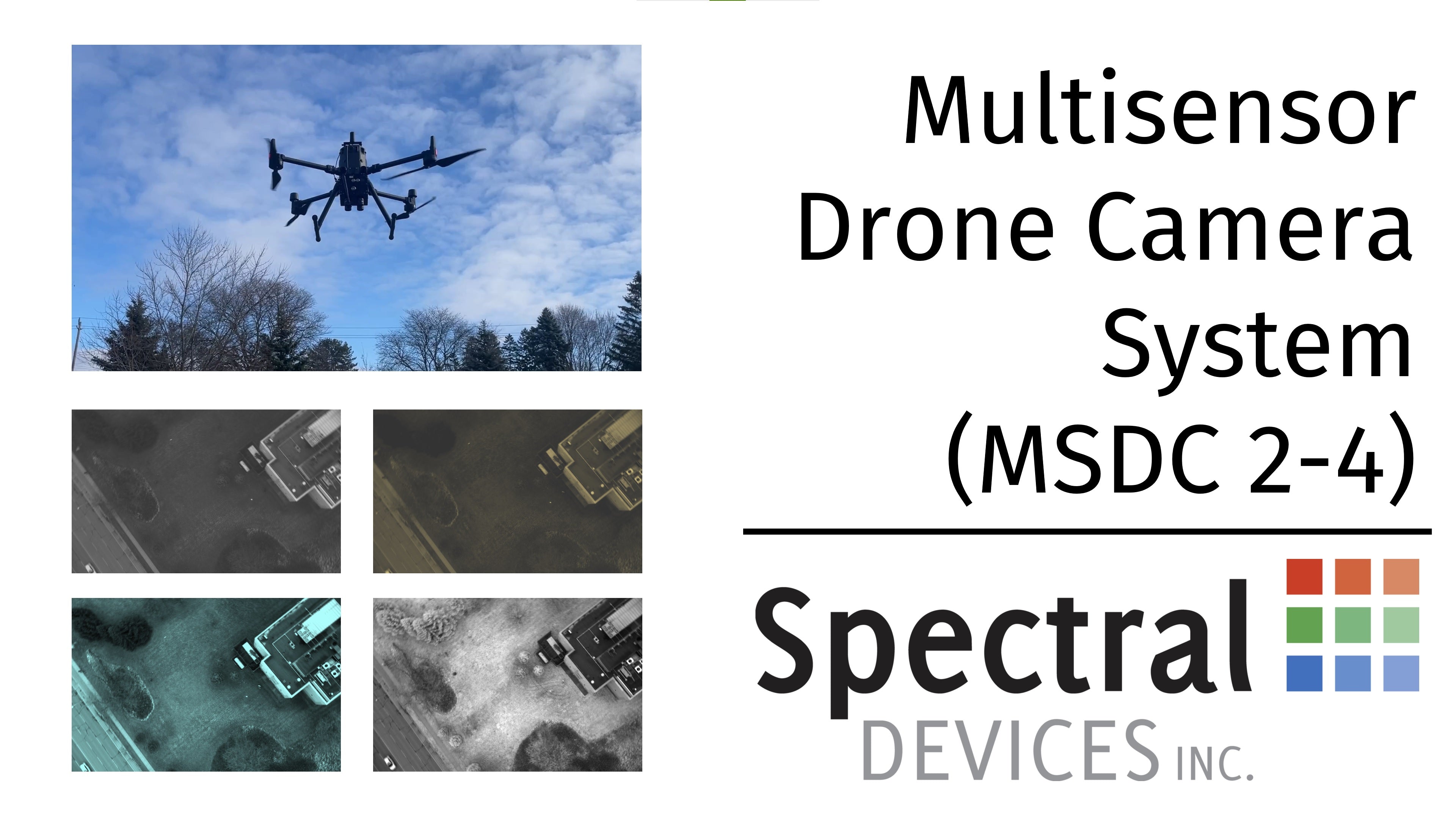
Collection: MULTISENSOR DRONE CAMERAS
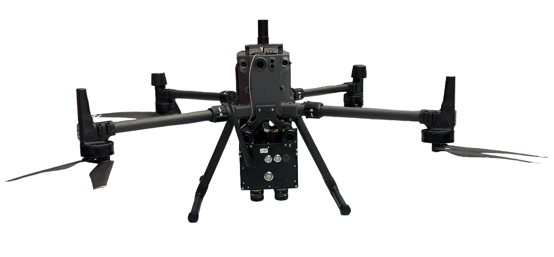
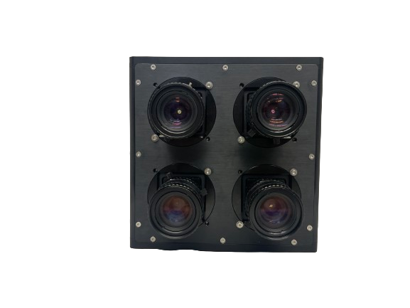
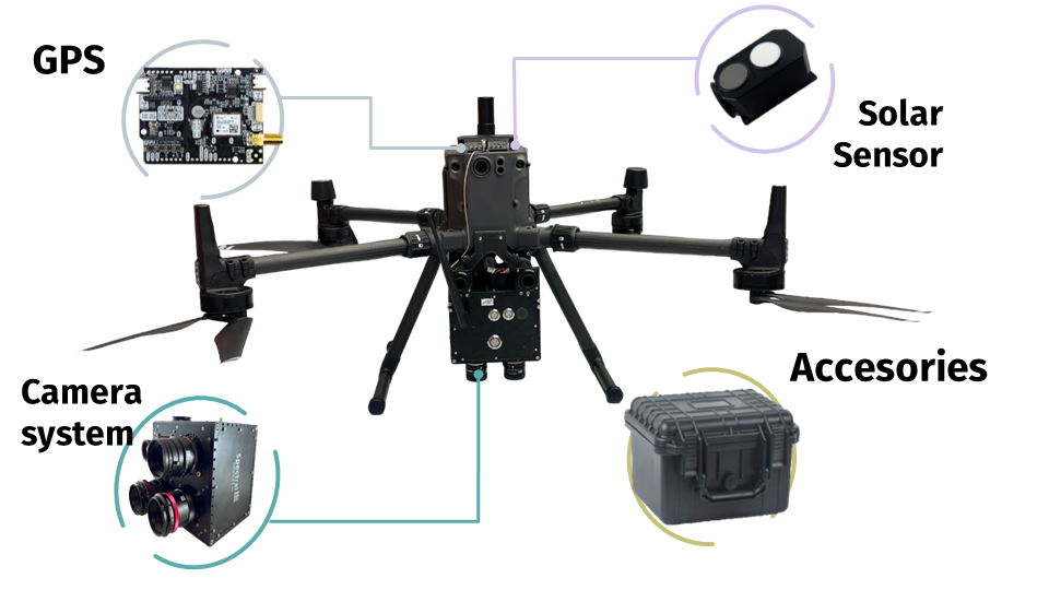
The multisensor drone camera is a turnkey, customizable, and upgradable multispectral imaging solution for easy integration into drones from DJI and others. Each system accommodates up to 4 cameras and includes GPS with RTK capability, RTK base station, and solar sensor standard.
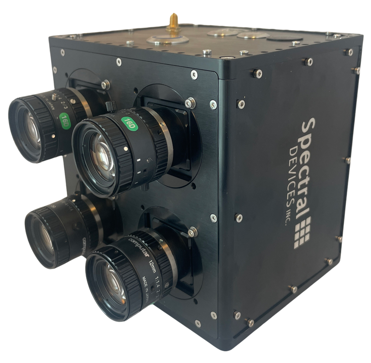
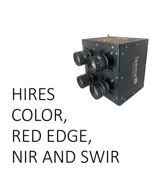
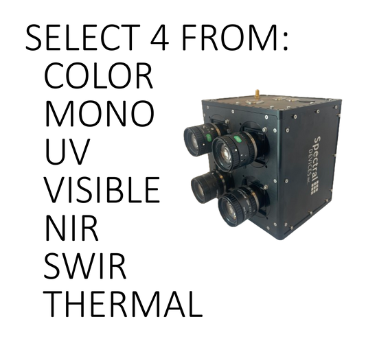
Customers can mix and match cameras with different spectral sensitivities (UV, VIS, NIR, SWIR, thermal), different numbers of bands per camera (mono, color, 2, 4, and 8 band multispectral), and different resolutions per band (up to 20 MP).
These systems are energy-efficient, lightweight and come fully configured with lenses, mounting hardware, on board processing, hardware synchronization, and easy to use image capture software. Each system also incudes msInspector, our Windows-based data inspection software for reviewing, correcting, calibrating, and geotagging images for orthomosaic mapping and other applications post flight.
-
Agriculture Multisensor Drone Camera
Regular price $0.00 USDRegular priceUnit price per -
Ultra-Wide Band Multisensor Drone Camera
Regular price $0.00 USDRegular priceUnit price per -
Super Spectral Multisensor Drone Camera
Regular price $0.00 USDRegular priceUnit price per -
Custom Multisensor Drone Camera
Regular price $0.00 USDRegular priceUnit price per


Customizable Multispectral Imaging for Drones
Customize your camera to perfectly suit your aerial imaging needs. Achieve optimal results with our versatile camera options from UV to thermal and monochrome to snapshot multispectral.
Works with Popular Drones
The MSDC-2-4 integrates with DJI M300-series drones and many others. Operates independently needing only 5-36 V DC power supplied by drone and ability to carry a load up to 1.7 kg.
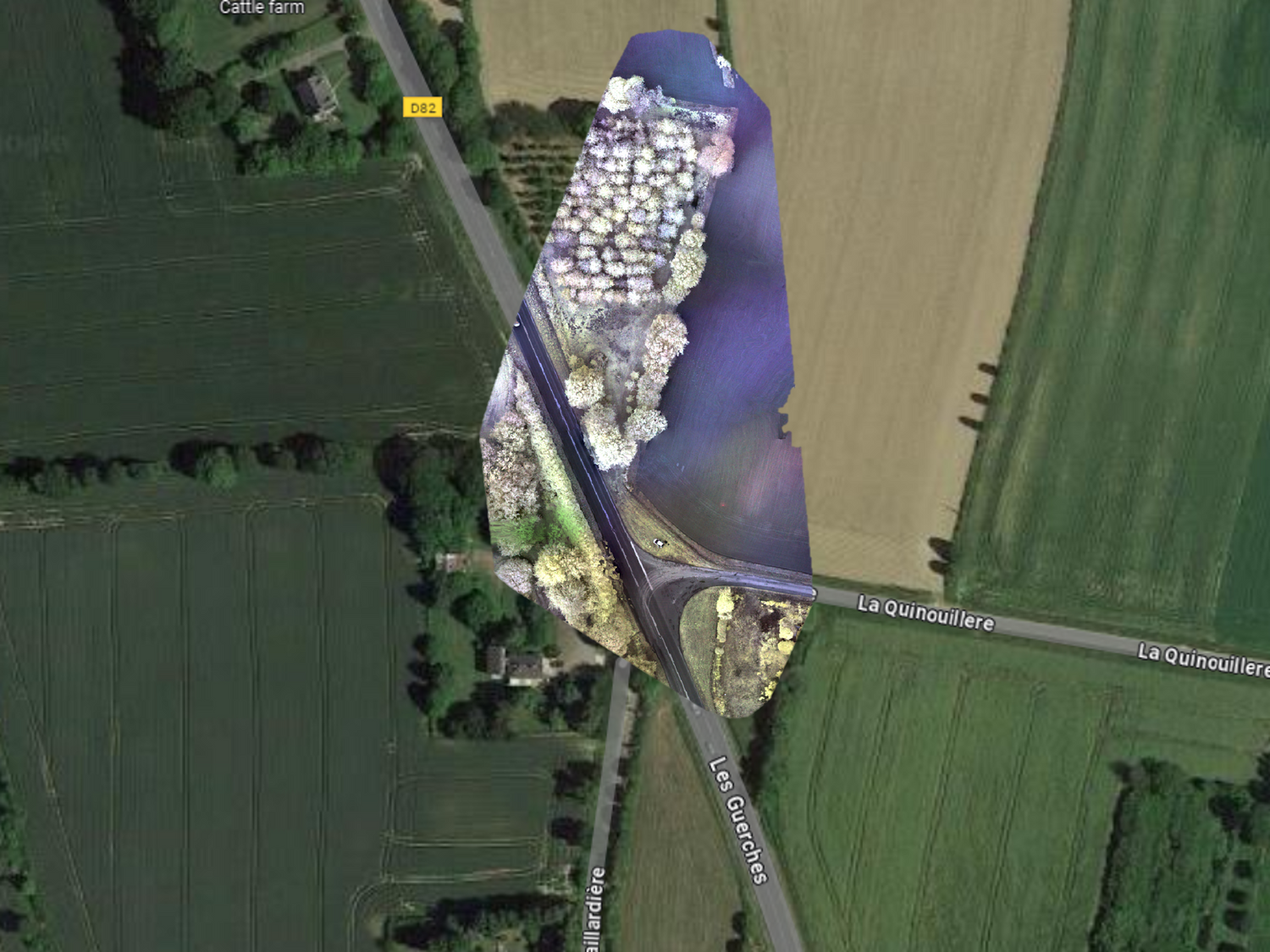
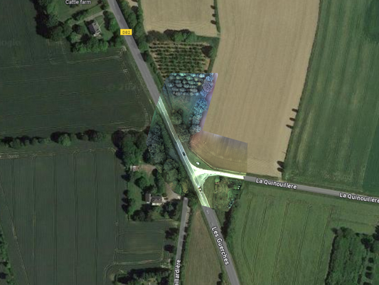
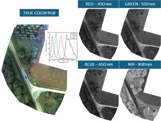
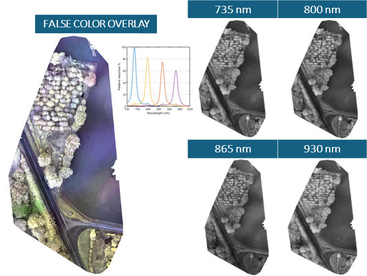
Multispectral Geo-referenced Orthomosaic maps
Generate multispectral orthomosaic maps. Geotagged images allow for reference with satellite imagery and maps.
Compact and Light-Weight
Ruggedly built, yet surprisingly light for a highly customizable multisensor drone camera. Systems range in weight from under a 1 kg to about 1.7 kg depending on the camera configuration.
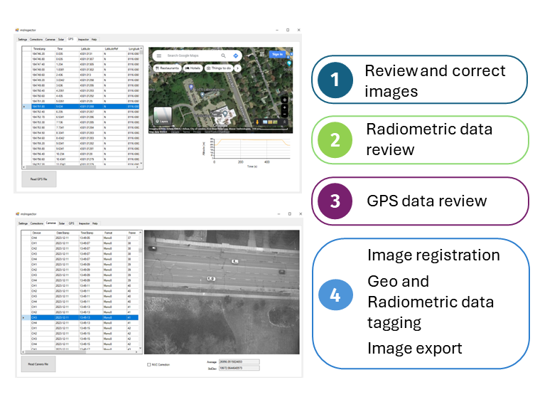
Powerful Image Processing Software
Use msInspector to inspect, correct, calibrate, and geotag images in preparation for mapping applications.
Complete Package
Complete package contains a fully configured MSDC-2-4 complete with all lenses and cameras, power cables, GPS cables, data cables, drone mounts, light weight GPS antenna, solar sensor, and a rugged and waterproof equipment case for transport and storage.
Applications
-
Geo-Referenced Orthomosaic mapping
Regular price $0.00 USDRegular priceUnit price per -
Example - Orthomosaic mapping with RGB-NIR camera
Regular price $0.00 USDRegular priceUnit price per -
Example - Orthomosaic mapping with BIO camera
Regular price $0.00 USDRegular priceUnit price per -
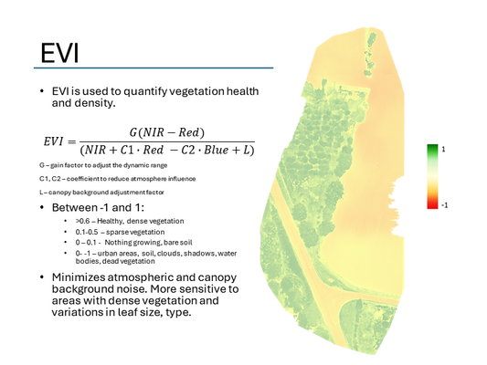
Agricultural Multisensor Drone Camera System Applications
Regular price $0.00 USDRegular priceUnit price per
Revolutionize Your Aerial Imaging: Introducing the Ultimate Multispectral Drone Camera System
Supported by Multispectral Imaging Experts
Our scientists and engineers have years of experience developing multispectral imaging solutions.
Contact us today to discuss your multispectral imaging needs.